See Yorkshire's Final Section of the King Charles III Coast Path
Yorkshire's last remaining segment of the developing King Charles III England Coast Path has been completed


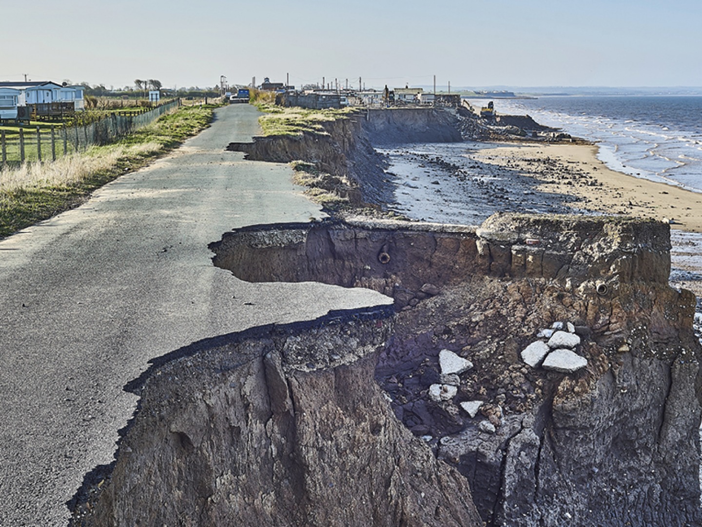
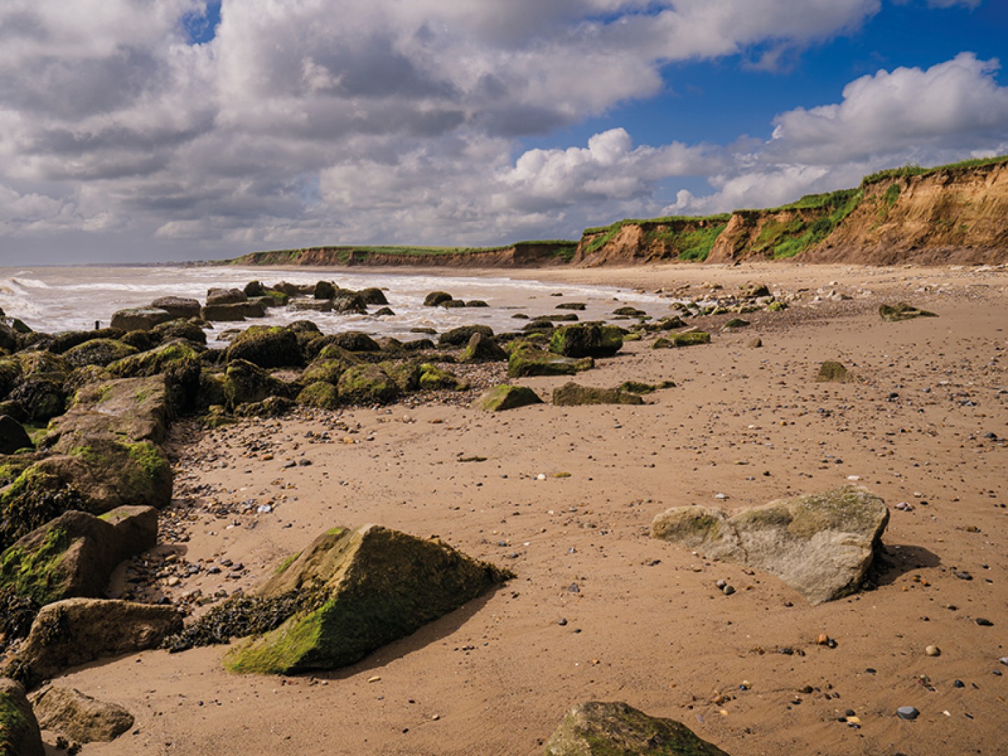
Stretching 42 miles from Easington to Bridlington, the newest section of the King Charles III England Coast Path covers a stunning yet often overlooked section of East Yorkshire and hugs the Holderness Coast. A continuation of the path which runs from the Scottish Border to the Humber Bridge and beyond, this particular section winds along a delicate piece of coastline that is under constant threat from coastal erosion, and is one of the fastest eroding areas in the UK. Creating a path here that is both accessible and long-lasting was no small feat, requiring a balancing act with local landowners and communities.
‘In many ways it’s one of the most challenging bits of the whole of the King Charles III England Coast Path,’ says Bruce Cutts, Natural England Senior Officer, when we catch up just after the official opening of the stretch. ‘Mainly because of coastal erosion and coastal change which as you know really dominate people’s lives in this part of East Yorkshire.’
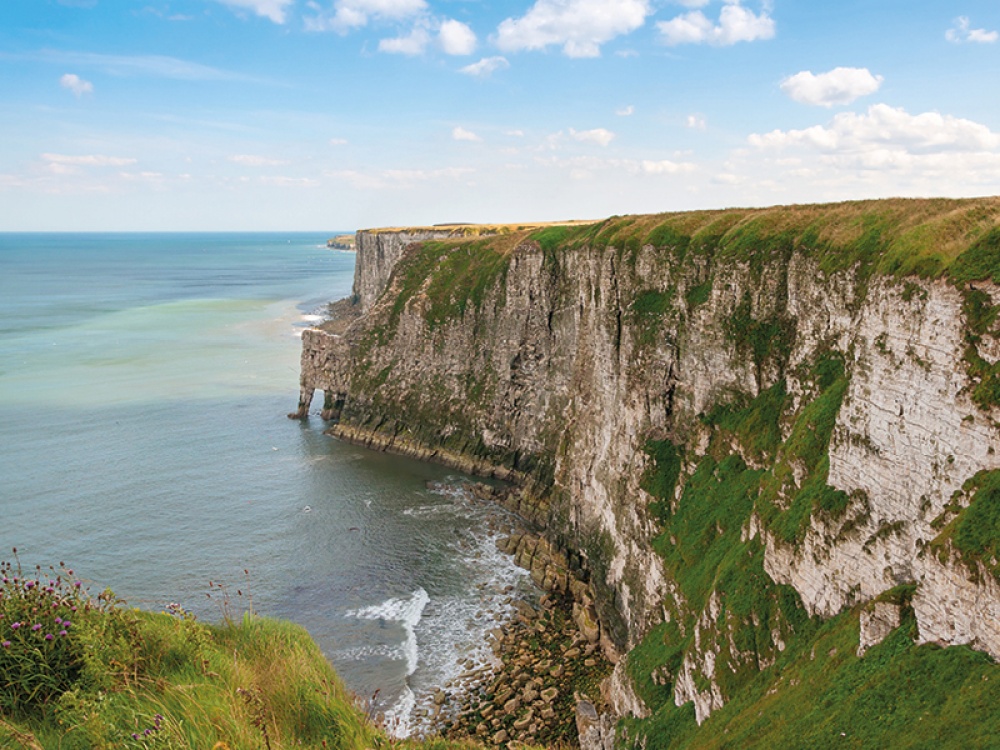
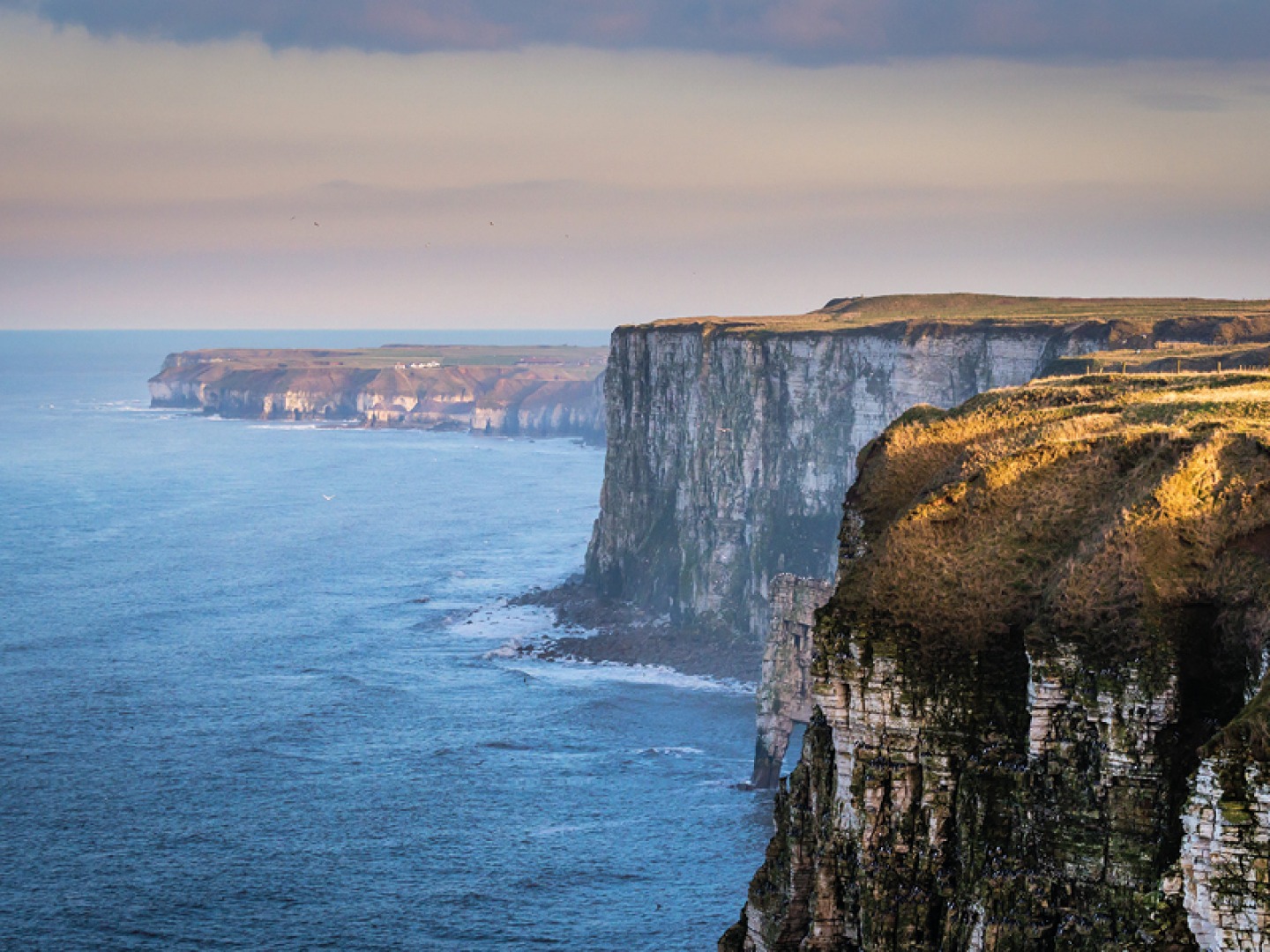
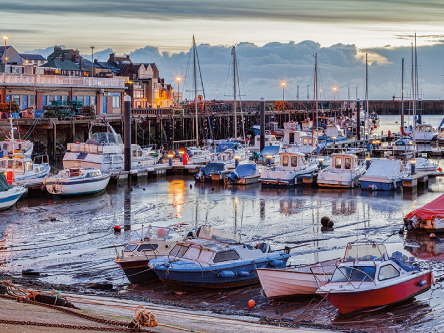
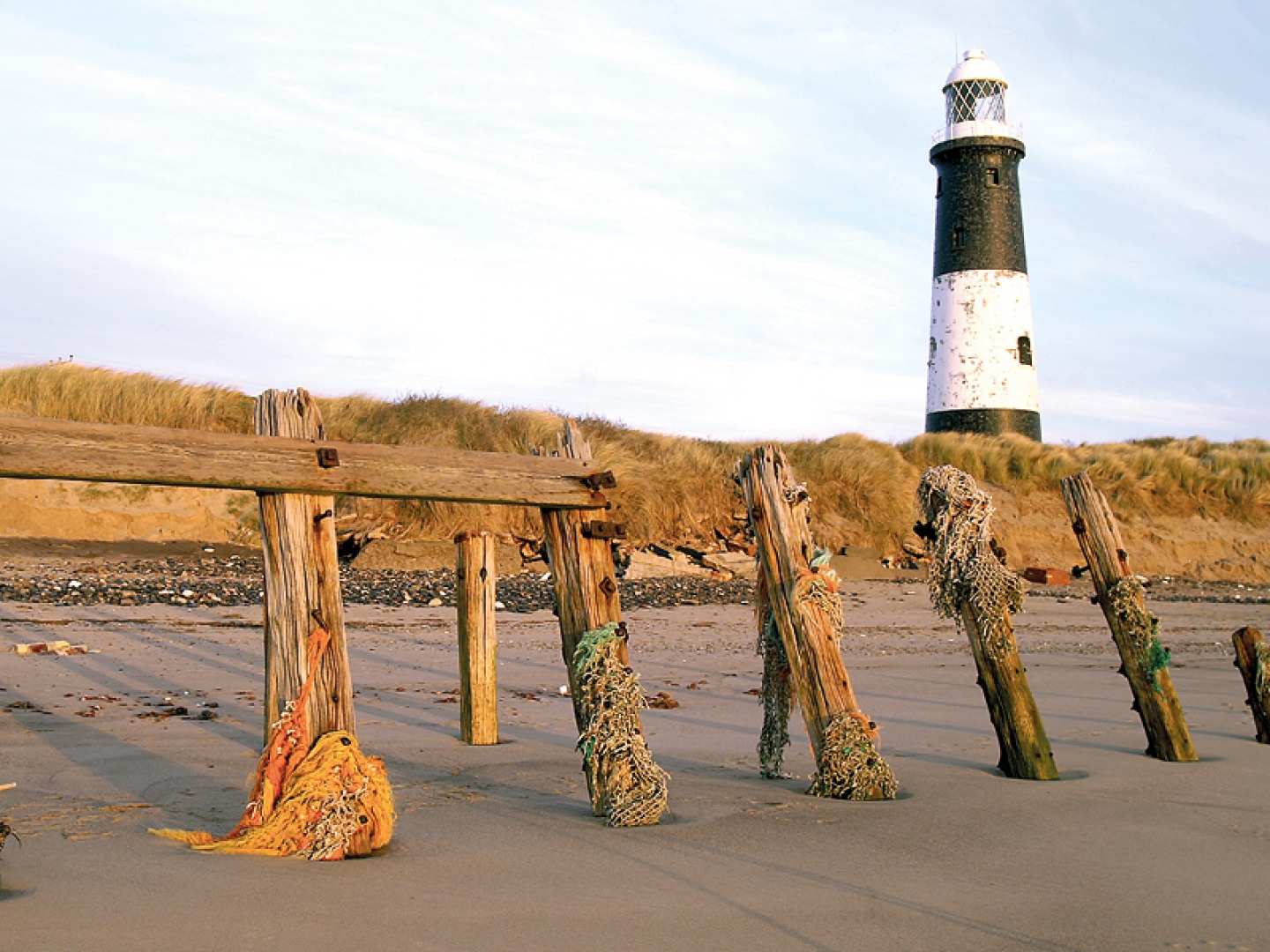
The area is a blend of stunning natural beauty spots – like Flamborough Head and Bempton Cliffs only a stone’s throw from Bridlington, and Spurn Point to the southernly end of the area, near Easington – as well as more urban hotspots like Hornsea and Withernsea. ‘We’ve got the urban areas of Bridlington and Easington but we’re also got the small rural villages along the way, and lots of farmland that it goes through,’ says Bruce. ‘It’s a really diverse piece of coastline, but also a really active piece of coastline in terms of coastal change.’
The concept behind the King Charles III England Coast Path is to help give coastal communities and visitors easy and unobstructed access to England’s stunning coastline. Coastal erosion in this area has made that increasingly difficult. ‘Before we started this work we did some analysis and found that 70 percent of the English coast has got secure access. The problem with that is that 70 percent was fragmented by the 30 percent without, so you couldn’t walk very far when you got to the seaside or got to the clifftop,’ Bruce explains.
Each area of the English coast came with its own problems for creating an accessible path, like the rugged terrain of the far north. In East Yorkshire, the issue which faced the team was longevity. ‘I think one of the big problems we’ve had with infrastructure on this bit of coast is making sure there is a degree of time [and] that those things like crossings and bridges actually remain useful as the coast changes so quickly. We’ve had to think ahead and design ahead,’ Bruce explains. ‘Where we cross field boundaries or watercourses we’ve made sure that they’re a little bit further inland so we get a few years of use before they have to be moved and rolled back due to coastal change.’
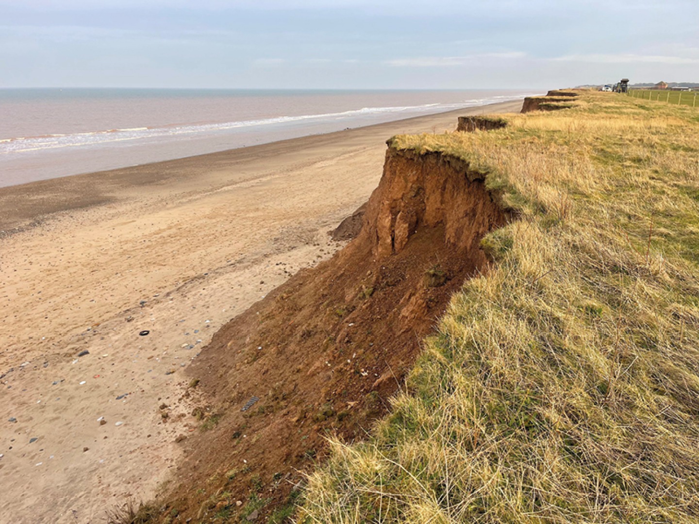
From the beginning, coastal erosion was a constant presence in the development of the path. ‘It won’t surprise you to know that in between doing the initial survey work and walking the course and meeting landowners, huge areas have fallen into the sea, so we’ve had to go back to actually roll back the path,’ Bruce says.
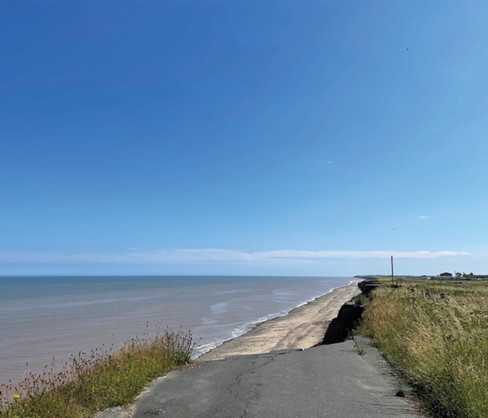
This ability to be ‘rolled back’ is a unique feature of the path which allows it to move and change with the environment, working in tandem with, rather than battling against, the effects of erosion along the coast. ‘The King Charles III England Coast Path is quite unique in many ways in that once a line of the path has fallen into the sea, we can actually roll that right back so we get continuous access.’
Having approval to move the path back as needed has helped secure the future of the trail, but Natural England are also sensitive to the communities and landowners being impacted as a result. Landowners in particular were consulted throughout the path’s development. ‘The biggest challenge that we had on that section was actually working with people that were losing their farmland, and losing their homes in some cases, to the sea,’ Bruce explains. ‘We started working with landowners on this bit of path nearly nine years ago now.’
The path has been created in a way that is mindful of the communities it passes through. ‘We work with them to achieve what we always try to achieve, which is a fair balance between public and private interest,’ he says. ‘We try to avoid their more active farm yards, active areas where they feed cattle, we always try to avoid horse paddocks and other areas where walkers could come into conflict with livestock.’
The practicalities of creating a path that’s accessible included removing stiles, avoiding the use of steps, and creating a smooth surface where possible. Bruce hopes the new path will become an asset for local communities by bringing in an increased number of visitors. ‘Locals will hopefully be able to take advantage of the business opportunities, whether that’s campsites, cafés, restaurants – anything. Hopefully, it’s a real catalyst of economic development and opportunity for people right around the coast.’
‘You come across roads that end hanging off a cliff, and buildings which are perilously close to the edge, and you can see the changes which are taking place before your eyes’
The scenery is breathtaking, and Bruce hopes people will enjoy the dynamism of the area. ‘It’s north from Spurn Point where you start to see for the first time some of the drama of the coastal change taking place,’ he says. ‘You come across roads that end hanging off a cliff, and buildings which are perilously close to the edge, and you can see the changes which are taking place before your eyes almost along the whole stretch.
‘I think this whole bit of coast is one of the most interesting bits of the King Charles III England Coast Path that certainly I’ve been involved in. In fact, it plays right into what we designed the path to do, and that is to respond to coastal change rather than be something that we have to defend. So it will move, it will be sensitive and it will hopefully then persist for the long term and provide the enjoyment and connection that people are looking for.’
Hopefully, with the future of the path in East Yorkshire secure, it will have a long term impact on future generations. ‘I think one of the longer term objectives we’ve got is trying to make the coastal fringe of the whole country into a wildlife-rich corridor where visitors can really see the value and splendour of our coastline,’ Bruce explains. ‘It’s something that we can all take a huge amount of pride in, and something that we can look forward to using for many years to come.
‘There’s a huge demand for walking along the coast and hopefully this will bring economic development and a degree of appreciation and understanding both of the dynamism of this particular piece of coast, but also the importance of the coastline and the coastal communities to nature conservation. It’s a way really of connecting communities together but also of connecting people with nature right around the English coast.’