Discover the New Bamburgh to Berwick The King Charles III England Coast Path Route
For the first time visitors have the right of access to explore more of our fabulous coastline, thanks to the newly-opened The King Charles III England Coast Path


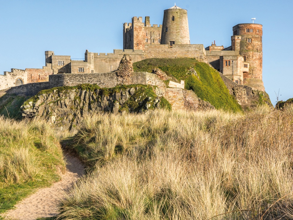
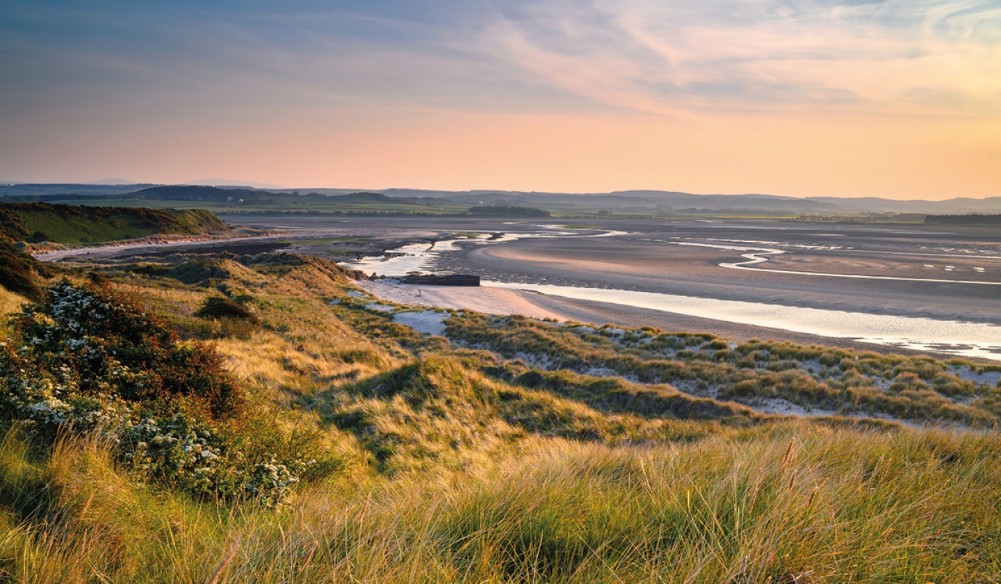
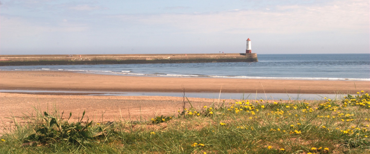
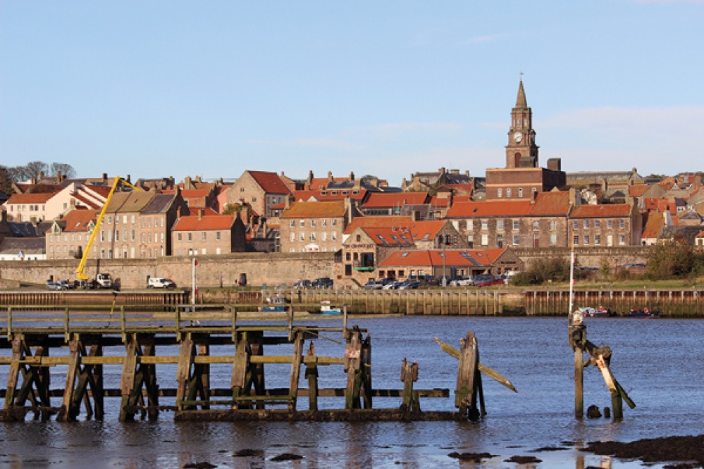
The Northumberland coast is known for its beautiful beaches, rolling sand dunes, geological diversity and historic past. Following the entire coast of England, and measuring around 2,700 miles, once complete The King Charles III England Coast Path will be the longest coastal path in the world. Natural England have been working in partnership with local authorities to open sections of the path throughout the country, and the most recent section to open is the one between Bamburgh and the Scottish border, which covers 38 miles.
‘This is a really important milestone for the England Coastal Path project because [the North East section] represents just over nine percent of the entire The King Charles III England Coast Path, that stretches from the Scottish border right down to Bridlington,’ explains Natural England’s senior advisor Bruce Cutts. The North East section amounts to 245 miles of continuous pathway, but has been broken up into further sections which Natural England are working on opening to the public, including the 38 miles from Bamburgh to the Scottish border.
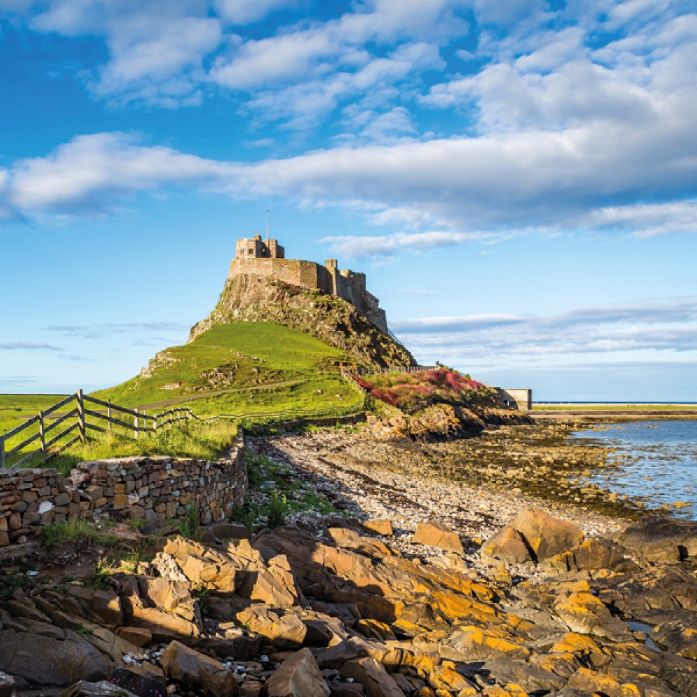
The easy-to-follow walking trail connects with the existing open trails, following wide stretches of sandy beaches and open inter-tidal mudflats which can be seen at low tide. The thoughtfully designed path allows walkers to explore from Bamburgh to Budle Bay, and on to Holy Island and Berwick, reaching Scotland at Marshall Meadows.
Read More: Five Fantastic Winter Walks With Pubs at the End
‘Certainly the Northumberland stretch of the coast
is probably, for me, one of the highlights of the whole
of the England Coast path’
The new path tries to stay as close to the coast as possible, meaning in many places the route is right on the coast. ‘From a purely practical level The King Charles III England Coast Path is of course a National Trail, so that means there is a good standard of way-marking with clear acorn symbols which is the trademark of National Trail access in England and Wales. People can look out for them and it means it’s easy to follow,’ Bruce explains.
‘Certainly the Northumberland stretch of the coast is probably, for me, one of the highlights of the whole of the England Coast path. You’ve got the expanse of the beaches, the amazing Holy Island, which now for the first time has a path right around the perimeter of it, and you’ve also got improvements to the existing Northumberland Coast Path which has been around in various guises for quite a long time. Because of the way we have worked on the path, and the way we have used new legislation and talked to landowners, we’ve been able to align the path a lot closer to the sea in many places so hopefully people can have a far better experience of our spectacular coastline.’
Creating new paths which link up to existing trails has meant improving signage and creating easier access. ‘We used a statutory scheme in order to form the alignment work that we did when we first designed The King Charles III England Coast Path. We always try and avoid beaches where possible, just because it’s hard work to walk on sand over long distances and it’s not always possible when the tide is in,’ says Bruce. ‘Most of the path is on natural surface, whether it’s grass, a field edge or other vegetation. Occasionally you’ll get hard surface where it’s particularly sensitive ground, or maybe when you’re going through urban areas on pavements or seafronts. However most of the trail is on natural paths which sometimes dip onto the beach and sometimes goes through the dunes, but most of the time you’re well away from high tide.’
Read More: The Amazing Health Benefits of Woodland Walks and Why We Should all Spend Time in Nature
Thankfully due to new legislation, Natural England has been able to bring paths closer to the sea. ‘Where negotiations on the public right of way had failed in the past, or not been pursued, we were able to go in with a fresh approach and get better access,’ explains Bruce. Working closely with Northumberland County Council, as well as landowners and farmers, Natural England has been able to agree a route which meets the requirements of the scheme, and also respects land management use, nature conservation such as bird sensitive areas and other issues along the coastline.
Despite the route from Bamburgh to Berwick opening to the public, Bruce explains there may be a few diversions depending on the time of year that walkers visit. ‘We work very closely with our colleagues on the Nature Reserve at Lindisfarne and with our own staff who work on protected sites to take very close notice of the concerns around disturbance, which is why we have a seasonal route in places to allow us to protect those areas at their most vulnerable times of the year. There is some amazing bird life, particularly around Budle Bay and around the Lindisfarne National Nature Reserve, therefore some of the route is only open for a short period during the summer. For the rest of the time walkers have to take a more inland route. This is all well way-marked so visitors know where to go when it comes to some of those more sensitive areas,’ he says.
‘Given that we are in crisis around nature and nature recovery is high on everyone’s agenda, not least our own organisation’s and local authorities’ agendas, one of the things we have to do in order to recover nature is to get people to understand, appreciate and value it. The only way you do that, I would say, is to actually get people out there, to connect with it, and to see the pressures it’s under, so you get more public support for the conservation work that we desperately need to do,’ Bruce adds.
‘People can walk the whole route which links the wild splendour of the Northumberland coast to the more industrial North East coast around Sunderland and Hartlepool on one continuous stretch of path’
The Natural England project has taken a long time and lots of planning. ‘Bearing in mind this work has been done on the back of the Marine Coastal Access Act which was in 2010, we have been planning and implementing the work for a long time now. It’s a huge piece of work and for the first time visitors have access to many beaches, and it’s a broad strip of access not just a linear path. The scheme requires us to consult with, and write a report that allows landowners and others with interest to comment, so it’s a very consultative process. The result of that is that we get a really good path with really good local buy-in, which hopefully will deliver some real benefit to local businesses, as well as visitors and locals,’ Bruce explains.
The King Charles III England Coast Path actually pre-dates the King’s Coronation, and the first work Natural England did as an organisation was back in 2005. ‘We were asked to look at whether there was an argument for extending access to the coast, but with King Charles III’s Coronation ministers asked if there was anything that we could do to celebrate the occasion and the idea was put forward to rename the England Coast Path, as it was, to The King Charles III England Coast Path. I think it is particularly fitting given the King’s association with a love of nature,’ Bruce says.
Over time, the path will have to adapt to take into account coastal erosion and natural environmental factors, but Natural England have already planned for this. ‘The beauty of the England Coastal Path legislation is that we can allow the path to move. If you imagine the situation further south along the East Yorkshire coast where there is coastal erosion up to 10 to 15 metres per year in some places, the legislation allows the path to move back as the cliff profiles change. Even on the Northumberland coast, if there are development works that take place or the dune system shifts, we can actually vary the line of the path to fit in with those changes,’ Bruce explains.
One of the great things about having the newly opened section of The King Charles III England Coast Path is having continuous routes that links to existing public rights of way along the Northumberland Coast. ‘Visitors will now be able to do circular walks that link into the path,’ Bruce says. ‘People can walk the whole route which links the wild splendour of the Northumberland coast to the more industrial North East coast around Sunderland and Hartlepool on one continuous stretch of path, so the variation will be really spectacular.’