Walk This Way: Teesdale
We continue our walk series in Teesdale, along High Force, Low Force and the upland meadows


Parking: Bowlees Visitor Centre, charges apply.
Starting/Finishing Point: Bowlees Visitor Centre, 3 miles north west of Middleton-in-Teesdale.
Distance: Approx 4 1/2 miles
Time: 2 1/2 - 3 hours approx
Difficulty: Easy to moderate, with a few short steep ascents and descents. There are occasional sections that are a little uneven underfoot, particularly along the riverbank.
Footwear: Robust trainers or walking boots. The walking is mostly excellent with paved/gravelled paths and tracks and easily followed paths across fields. The sections through the hay meadows can sometimes be a little boggy underfoot in wet conditions.
OS Map: Explorer Outdoor Leisure 31
OS Grid Reference: NY907282
Other: There are a few stiles and many gates on this route, particularly in the homeward half. The section from ‘Dirt Pit’ to ‘Brownlees’ passes through a succession of livestock fields containing both sheep and cows. A dog lead would definitely be required. Sections at both Low and High Force waterfalls can be very slippery, with significant falls and fast flowing water.
This walk is entirely within the North Pennines AONB and follows the River Tees, along the Pennine Way, past Low Force northwards to High Force before crossing the river and returning through the stunning upland meadows of Teesdale. The falls at High Force are formed where the Tees crosses the Whin Sill, its top layer made of an extremely hard igneous rock called Whinstone or Dolerite. Despite not being the highest falls in England (Cautley Spout in the Howgills and Hardraw Force in North Yorskhsire both have a greater drop) it lays claim to, when it floods, having the largest volume of water passing over an unbroken drop, thus gaining its name. ‘Force’ is taken from the old Norse word ‘foss’, meaning waterfall. It has attracted visitors for centuries and in 1816 the falls were sketched by Turner.
The Route
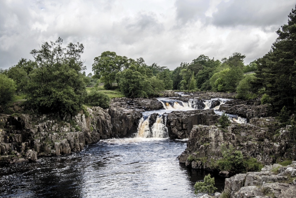
From the car park next to the visitors centre, head south west towards the main road Cross the road and join the signed footpath to the Wynch Bridge. Entering the woodland that runs down to the River Tees, it is worth taking a short diversion from the path down to the right of the Wynch Bridge to get an early view of Low Force (1). Return to the path and cross the bridge. This suspension bridge was built in 1830 to allow the lead miners of Holwick to cross the river to work in the mines of north Teesdale.
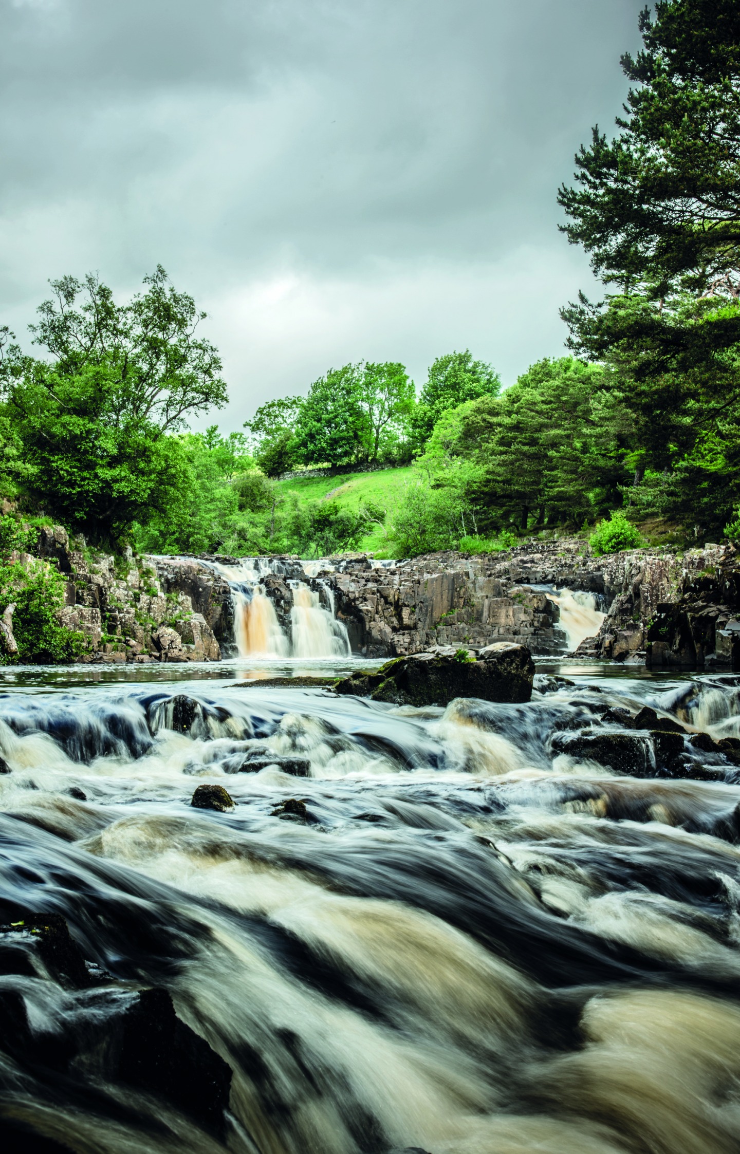
Turn right to join the Pennine Way heading north towards the Scottish Border at Kirk Yetholm. Pass the ‘Limestone Sheep’ and continue along the riverside (2). The verges along this section of the Pennine Way are home to over 200 plant species, many with wonderful names like ‘melancholy thistle’ and ‘shrubby cinquefoil’. At Holwick Head Bridge follow the path left, climbing towards High Force. As you climb, the sounds of cascading water can be heard long before you reach the falls. As the ground flattens out and before you reach the falls, if you take a small diversion to the right, there is a dramatic view over the waterfall dropping 21m to its deep plunge pool. There is a vertigo-inducing drop from here to the river below and no restraints or barriers, so take great care if walking with children.
The prickly evergreen shrubs you pass as you wend your way up to the falls are part of the largest juniper wood in England. Despite the current attack they are under from a microscopic fungus-like organism that has caused them to die back in large numbers, they still provide a magical backdrop to this section of the walk.
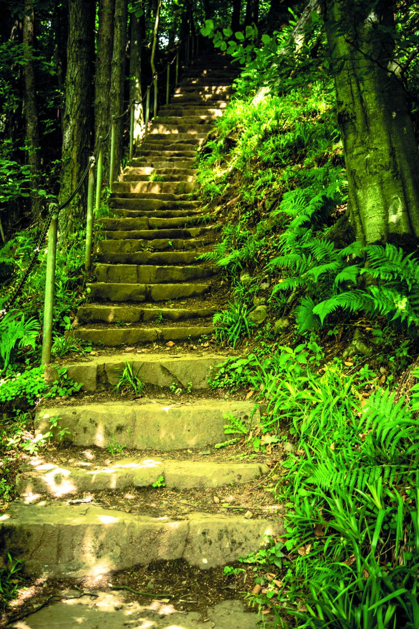
From the falls return back along the same path and cross the bridge to the north side of the river. Turn left along the riverside path and as the field narrows turn right up the steep stone steps (3). Carefully cross the road towards the High Force Hotel, where any requirement for refreshments (or the toilet) can be amply catered for. Turning right, we pass between the hotel and the gift shop and right again through the (somewhat neglected) backyard, before exiting through a small gate and onto the first section of meadows. Follow the path as it bears left and climbs to a gateway and then over a stile into more open countryside. (4)
Passing close by an old barn on our right, it is worth noting that many on this side of the valley are painted white. This signifies they are part of the Raby Estate, owned by Lord Barnard. Follow the path across the fields and down towards Dirt Pit. The low point of this field can be a little wet underfoot and there is a small, slightly warped bridge that will take you over the wettest point.
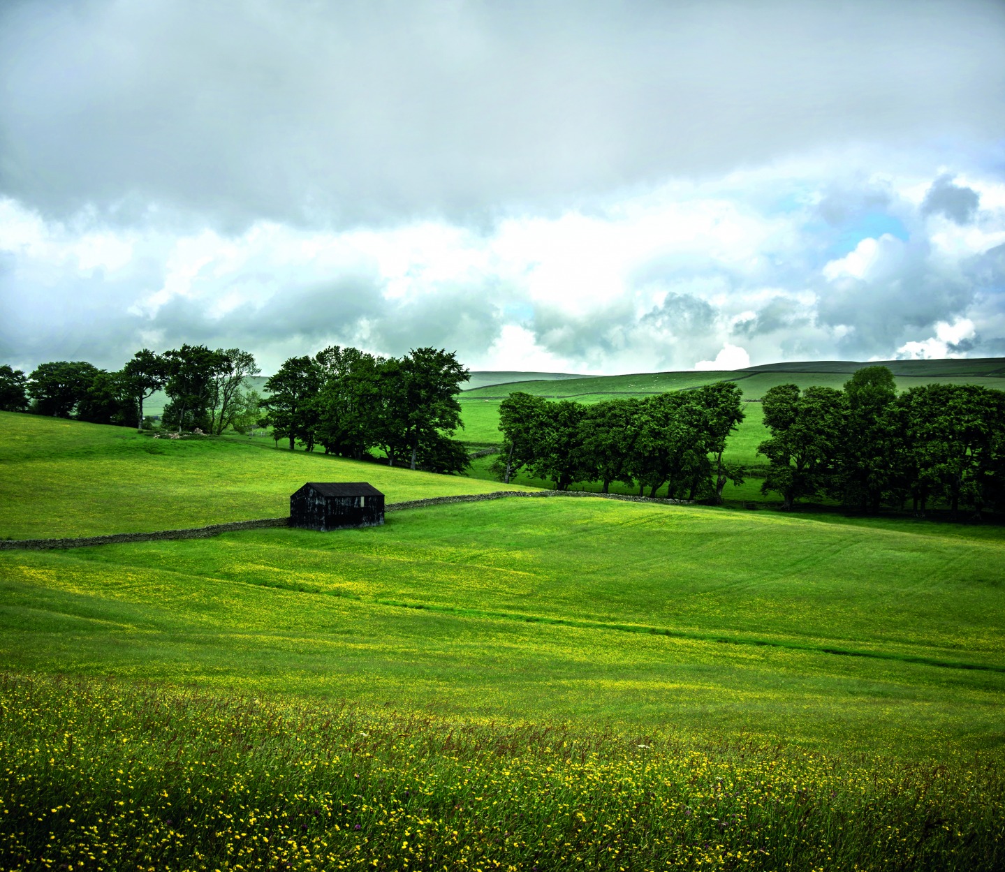
Gently climbing, we pass through the last section of beautiful upland hay meadows (5) of which the North Pennines boasts over 40 percent of the UK total. The traditional farming methods of the area ensure that in late spring and early summer these fields are awash with yellow and magenta wild flowers.
At the stile, cross the road, go straight across at the junction and follow the lane down towards Dirt Pit. Cross the river and follow around to the right. Continue through the gate and join the track towards Bowlees. As we climb up this gravelled road, excellent views of the surrounding landscape emerge to our right, and from the top of the hill we can clearly see a ‘v-shaped’ notch taken out of the hillside on the opposite horizon. This ‘hush’, known as Coldberry Gutter, is the largest and most significant of its kind in the North Pennines and is a remnant of the large lead vein that was excavated there from the mid-19th century. It is particularly unusual in that it cuts through the watershed between neighbouring valleys.
From here we gradually make our way down past a succession of eye-catching whitewashed barns that are perfectly interwoven with the network of dry-stone walls. At the foot of the hill we re-emerge back at Bowlees Visitor Centre. Housed in an old Primitive Methodist Chapel, it has a gift shop, gallery and a good selection of food and drink at its in-house café. There are also accessible toilets and a picnic area here.