The Ultimate Guide to Photographing Northumberland
Local photographer Anita Nicholson has put together the ultimate guide to photographing Northumberland – with everything from grid references to advice on when to visit and what to shoot


Anita’s day job is in the housing sector, but her photography has developed from a hobby into a real passion. After being persuaded to set up in business, she now describes herself as wearing ‘many hats’. ‘Photography is both a passion and a source of income, and I use it to support local charities too,’ she explains. ‘Mostly I do nature photography, embracing landscapes, seascapes, wildlife, flowers – anything in the great outdoors.’
After being approached by FotoVue (a publishing company who work with photographers to create beautiful and well-regarded photo-location guidebooks for regions, including The Lake District and The Peak District), Anita took on the challenge of creating the ultimate guide to photographing Northumberland. After five years of hard work, Photographing Northumberland is now complete. ’It was an honour to have been asked, and to get the opportunity to be involved in a book on Northumberland,’ says Anita. Keen to include off-the-beaten-track locations, as well as Northumberland’s iconic places, Anita spent a lot of time researching. ‘I used the knowledge I’d built up over the years, bought local history and poetry books, studied maps and the internet and picked people’s brains,’ she says. The valuable help and advice she received led her to decide to give back to the Northumberland community using the profits from the book, some of which go to local charities and The Woodland Trust in support of their tree-planting campaign.
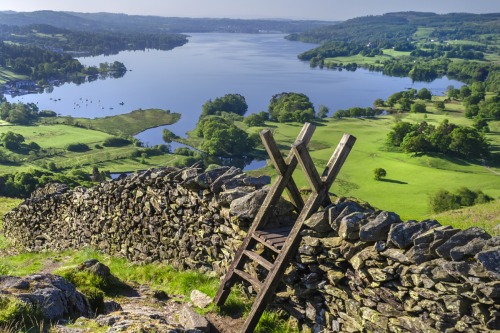
‘One of the many things I love about Northumberland is the sheer variety of locations we have,’ Anita continues. ‘We’re spoilt for choice with stunning sandy and rocky beaches, countless castles, beautiful remote valleys and hills, heather-clad moors, pockets of ancient woodland, great swathes of forests, an abundance of wildflowers and wildlife, pretty villages, towns and gardens, dark skies for astrophotography and ancient historic sites too.’
Getting out into nature with her camera is how Anita likes to relax, and she has a particular love for the county’s quiet places – including Duddo Stone Circle, College Valley and the view of the Cheviot hills from Blawearie. ‘If you love the outdoors then there’s something for everyone here, and there’s just so much space – some days you can have places all to yourself with just sheep, the occasional farm dog and wildlife for company,’ she says. ‘Something that I’d not appreciated until I moved here is the length of the days in summer – around summer solstice it barely gets dark, there remains a hint of dusky sunset colours on the horizon almost for the entire night.
‘When you look at the world through a camera lens and really pay attention to nature, you see even more clearly just how extraordinary our world is, the colours are richer, the light dancing across the land is glorious, the flowers are more delicate – photographing nature is a joy, and I’m very lucky to have it as my hobby, and business, and to have had the opportunity to work on this book.’
Anita is already working on new locations for a future edition of the book, and some of these new locations are available on her website now.
Lat/Long: 55.604086, -1.696743
what3words: ///misted.unfolds.redouble
Grid Ref: NU 192 345
Postcode: NE69 7AX
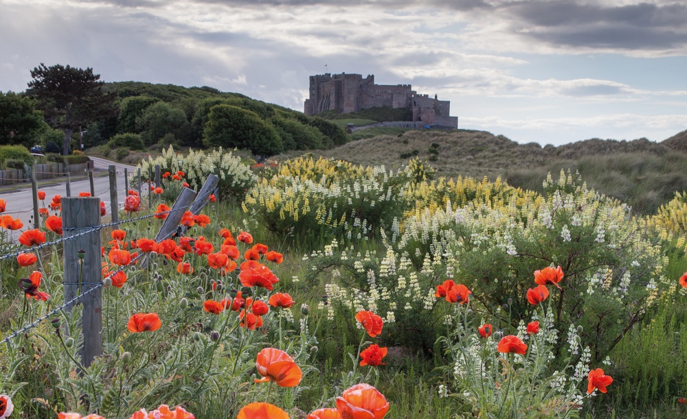
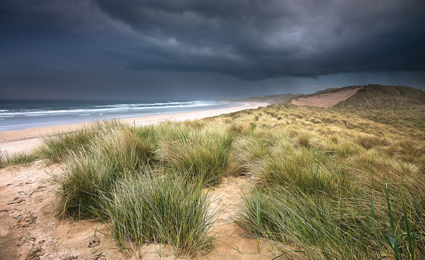
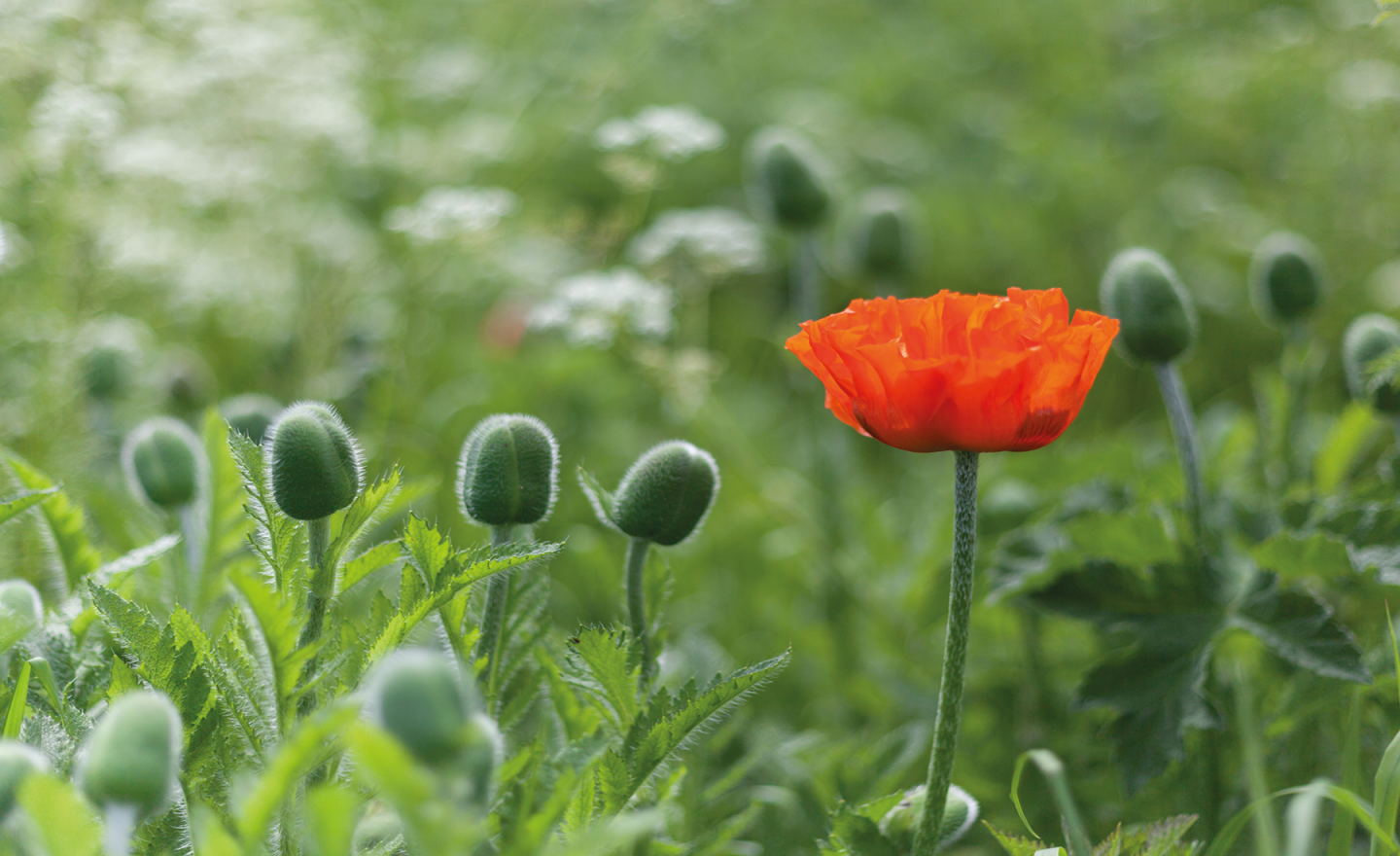
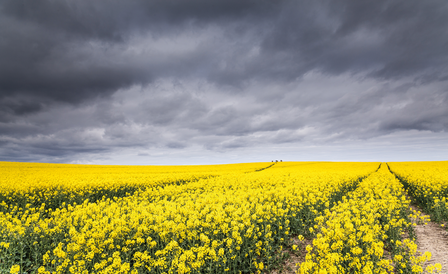
To the south of Bamburgh Castle lie several miles of Marram grass-covered sand dunes and golden sandy beaches reaching down to the harbour town of Seahouses. In the early summer months the castle can just be seen above a dune-grass meadow filled with naturalised bright red ornamental poppies, wild lupins and many other flowers; for a brief month or so every year this looks like the Garden of Eden – a beautiful sight.
What to shoot and viewpoints
Every year photographers visit the poppy meadow to capture a photograph of Bamburgh Castle peeking over the bright red poppies, or to photograph the swathes of poppies themselves. The dunes here and the miles of empty sandy beach to the south also have huge photographic potential. If you’re lucky, you might see the remains of an old shipwreck around low tide just to the south of the castle, although this is often covered by sand so can be elusive.
Best time of year/day
The best time of year for the poppies and wildflowers is around June. For side-light on the poppies go at sunrise; for back-lit poppies go at sunset. However in June, from the poppy field, the sun sets behind the castle so you’ll be shooting into the light and the castle will be a silhouette.

Lat/Long: 55.676699, -2.109755
what3words: ///column.cold.robes
Grid Ref: NT 931 425
Postcode: D15 2PS
Duddo Stone Circle, which has been dated back to the same era as Stonehenge, is an ancient site in the north of Northumberland.
This wonderfully peaceful location, to which visitors have access via a permissive footpath, thanks to the kindness of the landowner, inspires both reflection and creativity. The stone circle is set in the middle of a farmed field and has expansive views of the surrounding countryside, including the Cheviot Hills to the south.
What to shoot and viewpoints
Duddo Stone Circle and footpath, from the edge of the field
The stone circle sits on the brow of a small hill, enabling it to be seen clearly as you head towards it and inviting longer-view photographs to be taken from the edge of field in which it’s located. The sense of history is palpable here, especially on a dark, moody winter’s day.
Duddo Stone Circle sunrise
Closer up, the detail of the carved stones can be appreciated. They appear to be facing outwards in hand-like shapes, instilling wonder and further enhancing the sense of peace here.
Duddo Stone Circle footpath in the summer time
The field’s crop is rotated every year, including periods of set-aside when daisies flourish here, presenting a variety of interest. Again, taking a longer view along the footpath to the stone circle provides a sense of space and emptiness – you often find you have the whole place to yourself, even in summer time on a beautiful sunny day.
The pretty little country road to Duddo Stone Circle
Parking for Duddo Stone Circle is on a grass verge next to a clear sign and footpath post that show the way to the monument. The country road is a treat in itself, as it’s lined with trees that resemble lollipops and is immaculately kept.
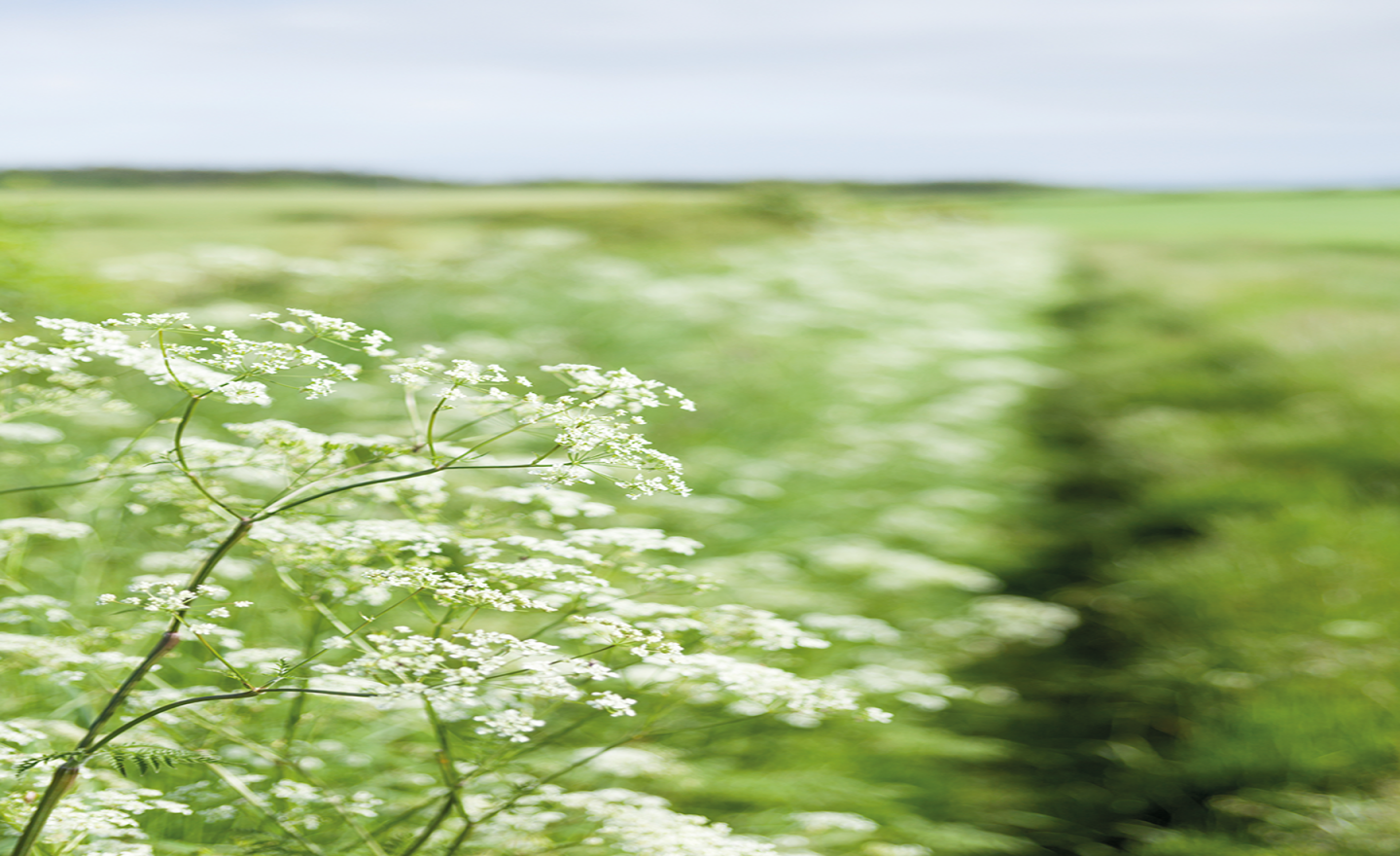
Footpath to Duddo Stone Circle in the summer time, overflowing with cow parsley
The verges to the side of the footpath that leads to the stone circle are bursting with flowers and wildlife all year round and look especially pretty in the summer months.
Best time of year/day
The stone circle is worth a visit at any time of year, as the crops and character of the seasons change. The landowner requests that visits to the site are made between dawn and dusk. Parking is limited, however, this is a very quiet location even in the summer months.

Lat/Long: 55.545714, -2.169588
what3words: ///cycled.gambles.slot
Grid Ref: NT 893 280
Postcode: NE71 6TW
Hethpool is a small hamlet located in College Valley, which is privately owned by the Sir James Knott Trust and managed as College Valley Estates by a board of directors as an environmental, social and economic place of excellence.
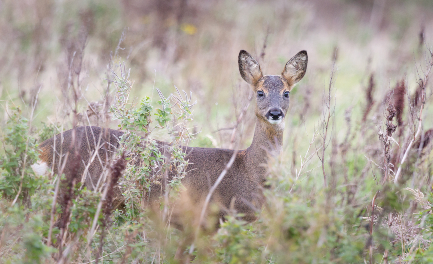
The name Hethpool is derived from ‘Pool at Hetha’ from the name Great Heathea, a small hill next to Hethpool – one of many in the area that has the remains of an ancient fort on the top. Hethpool is a pretty place with handsome estate cottages, Hethpool House, which stands beside Hethpool Lake, paddocks with horses and sheep, and Hethpool Mill over a small bridge across College Burn. This is a peaceful and beautiful location, with footpaths leading the visitor along the valley towards Cheviot, or down to and along College Burn to join St Cuthbert’s Way. College Burn has small, plunging waterfalls that cut through a rocky gorge, deep pools where locals swim, crystal-clear waters and a rich diversity of flora and fauna, including dippers and sea trout. The area is also home to deer and birds of prey.
What to shoot and viewpoints
Hethpool is a picture-postcard hamlet, surrounded by trees, paddocks and gentle hills, and as such, a pretty place to photograph. College Burn is simply gorgeous – it’s a photographer’s dream – with rapids, falls and beautifully clear waters. There is plenty here for the wildlife photographer too, and time sitting beside College Burn is time well spent at any time of year, though perhaps one of the most dramatic sights occurs in autumn: by the lower falls beneath the wooden bridge, you can watch trout leaping up the churning, dramatic waters when the burn is running high.
Hethpool Lin
From the car park there is a footpath that starts at its east corner and follows College Burn downstream to the bridge, Hethpool Lin (a waterfall) and the narrow, rocky gorge.
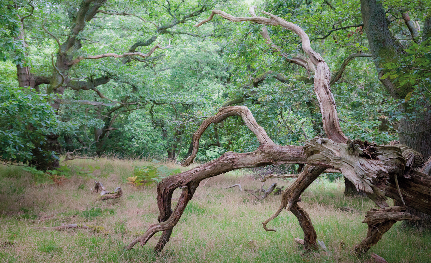
Collingwood Oaks
For those interested in photographing woodland, half a mile north of Hethpool on the west slopes of The Bell, opposite Hethpool Lake, are two beautiful stands of oaks. The trees were planted as acorns in the 1800s by Sarah Collingwood, who inherited Hethpool from her aunt. Sarah was the wife of Admiral Lord Collingwood, who took command of the Fleet after Nelson’s death at the battle of Trafalgar in 1805 and led the navy to victory over the French.
Best time of year/day
Hethpool and College Burn are beautiful all year round, but this is an especially beautiful location in autumn when the trout are leaping and the trees are in full autumn colour. The burn looks magical in golden light on a late summer evening as dippers dart busily along the gorge.


Lat/Long: 55.322510, -1.5514930
what3words: ///readings.language.boast
Grid Ref: NU 285 032
Postcode: NE65 0JW
Situated just to the south of Amble, the hamlet of Low Hauxley nestles behind sand dunes that line a long, quiet stretch of sandy coastline running down to Druridge Bay. The beach looks out towards Coquet Island, an RSPB reserve with a large population of terns, puffins and eider ducks.
This location is also known for its archaeological treasures with the stumps of an ancient forest now clearly visible along the high tide line along a section of the beach. The stumps, which were preserved by peat and sand, are believed to date back more than 7,000 years and are the remains of Doggerland – an area of bogs, marshes and forest that connected the British Isles to mainland Europe. Archaeologists have also uncovered animal footprints and it is believed that red deer, wild boar and brown bears would have roamed the ancient Doggerland forest. These stumps and trunks of preserved trees make great photographic studies and offer a glimpse into the distant past. Northumberland Wildlife Trust’s superb Hauxley Wildlife Discovery Centre is here and kids in particular will love it.
What to shoot and viewpoints
Besides photographing the ancient forest remains, seabirds and Coquet Island, Low Hauxley beach is popular as a sunrise-seascape location, its shallow, layered rock formations providing strong leading lines out to sea. Coal fragments also create interesting patterns of the flat pale sands.
From the Low Hauxley parking bay you can scramble over the dunes following braided paths, but it is steep to get down to the beach. More straightforward and safer is to walk down the road, heading south to Low Hauxley village where a flat path leads to the beach. There are no specific viewpoints described but straight in front of you and up the beach towards Amble are rock platforms the stretch out to Coquet Island in the north east.
Further north towards Amble you will find the stumps and trunks at the high water mark, though it’s easier walking if you park in front of the Amble Links Holiday Park. From this free parking spot cross the dunes on braided paths to the beach. You can then explore the stumps and trunks from there.
Best time of year/day
For photographing rock formations at Low Hauxley it can be best to wait for a mid to low tide and to follow the tide out if you want to capture them wet and reflecting the colours of a sunrise or sunset sky. A higher tide is ideal for photographing seawater swilling around the remains of the ancient forest, though be aware if the tide is too high, they will be submerged.

Photographing Northumberland by Anita Nicholson is published by Fotovue, £26.95