Walk This Way: North York Moors
We continue our walk series through the North York Moors, passing Roseberry Topping and Captain Cook’s Monument


Parking: Great Ayton. There is plenty of free parking in the village itself including a small car park at the tourist information office.
Starting/Finishing Point: Great Ayton Tourist information centre.
Distance: Approx 7 1/2 miles.
Time: 4 hours approx. Due to the steepness of some sections, timing will vary according to fitness and walking pace.
Difficulty: Medium. There are several very steep climbs, particularly to the top of Roseberry Topping and again from Gribdale Gate to Cook’s Monument. Neither though requires any scrambling. There is a steep descent from the Topping and another increasingly steep and uneven track through the woods from Cook’s Monument. The section through the woods can be uneven underfoot. There are many gates and stiles.
Footwear: Walking boots or robust trainers if the weather has been dry. With the exception of the section described above most of the walking is excellent; on paved steps and tracks and clearly marked footpaths.
OS Map: OL26
OS Grid Reference: NZ563106
Other: There are several sections through grazing land where dogs will need to be kept on a short lead. This also applies to the open moorland areas (particularly over Newton Moor) between 1 March and 31 July, when many species of ground nesting birds are prevalent. There is also a single railway crossing to carefully negotiate. There are several public toilets in Great Ayton and innumerable places to get hot and cold refreshments.
Great Ayton is inexorably linked with the story of Captain James Cook who, although born in nearby Marton, attended Postgate School in Great Ayton and lived for some time at Aireyholme Farm which we pass later on in this walk. As a teenager Cook had served in the Merchant Navy, but it was during his time in the Royal Navy (from 1755 until his death in 1779) that he made his name as not only Captain but as an explorer, cartographer and expert navigator. His three major Pacific voyages covered many thousands of previously uncharted ocean miles from New Zealand to Hawaii, which he mapped with great detail, accurately surveying and recording many hitherto unknown coastlines and islands. Cook was killed in Hawaii on 14 February 1779 whilst trying to kidnap the native chief of the Island. The monument dedicated to him on Easby Moor was erected in 1827.
The Route
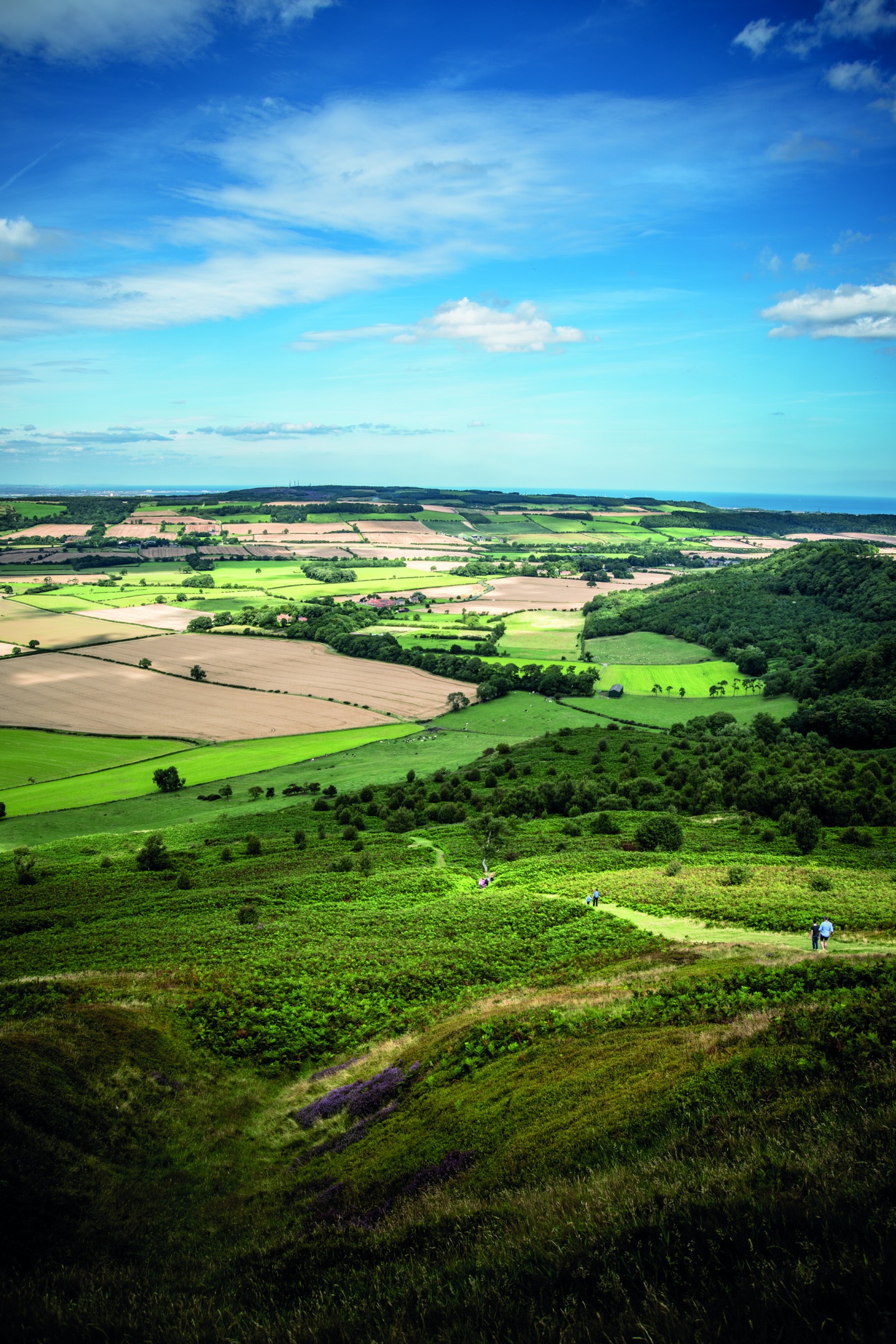
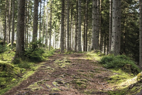
Leave Great Ayton, heading north along Newton Road, until we reach a mini-roundabout. Turn right here into Roseberry Crescent and follow this around the gentle rise and curve until we reach a footpath signposted right up a short and narrow alley at house 102. Take this footpath and entering the field, continue on the path up towards the railway line. At the edge of the field pass through the gate and turn left, walking parallel to the railway, before turning right to cross the bridge. From here the main path heads right, but take the left narrower path into Newton Wood. Passing through this beautiful broad-leaved woodland watch out for mature oaks, sycamore and ash that provide the perfect habitat for a rich array of birdlife including wood warblers, flycatchers and greater spotted woodpeckers which can frequently be heard in the near distance (1). From here we can catch a tantalising glimpse of Roseberry Topping through the trees to our left. At the next fork take the left path and then at the following fork bear left again. At the next fork, recognisable by the flat, triangular rock marking it, we bear left again. Our route takes us in a gentle right-to-left curve along the edge of Newton Wood with views over the flat and open landscape to our left.
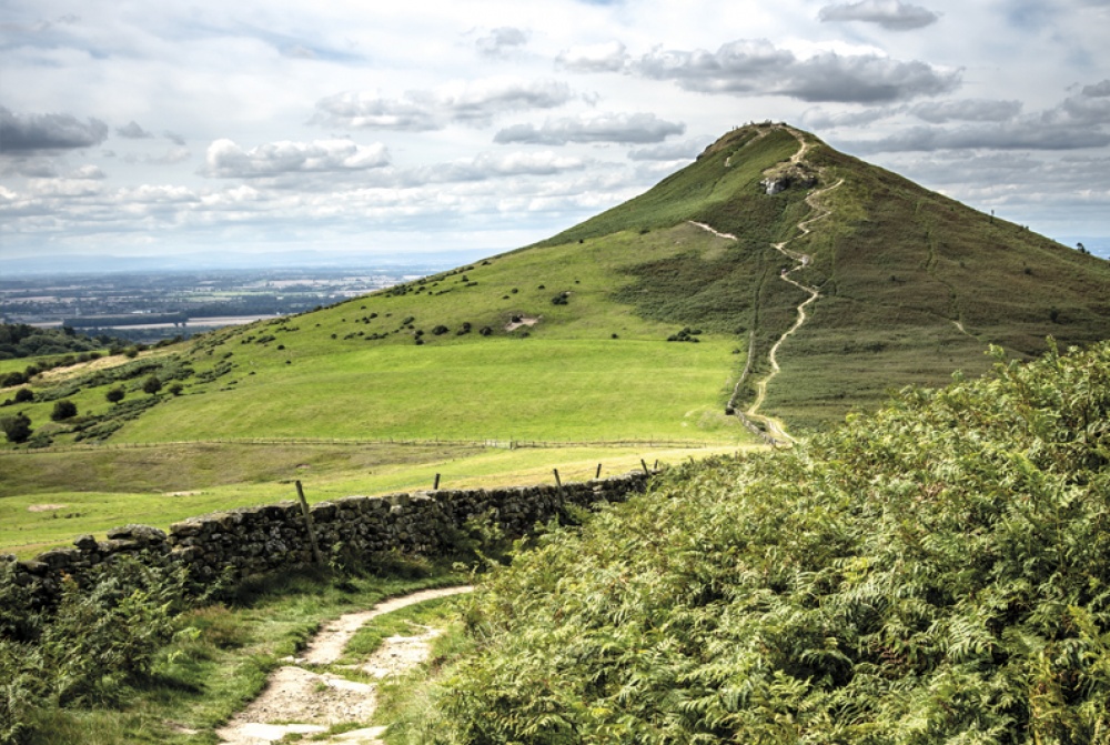
On reaching the bridleway we again turn left. Soon we pass a gateway on our left. This is another popular starting point for a jaunt over the Topping. Continue straight on to the next signpost and here turn right up the increasingly steep stone steps for the 320-metre climb to the top of Roseberry Topping. Pausing on the way up, there are great views east to the open sea and across the Cleveland Plains towards the Pennines some 50 miles away. (2)
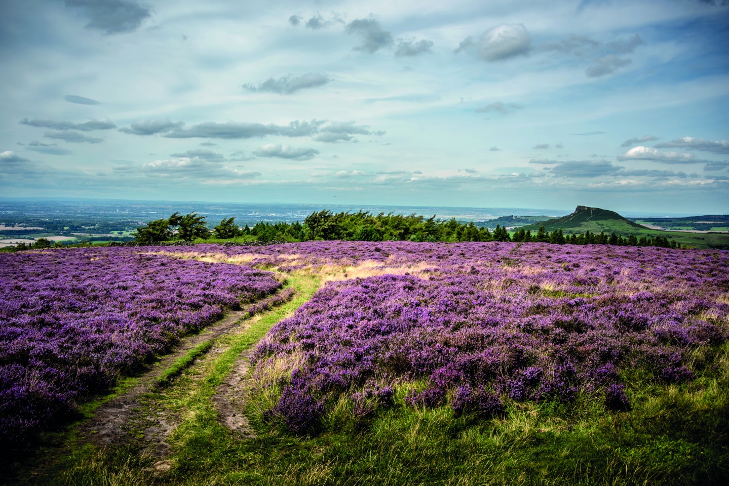
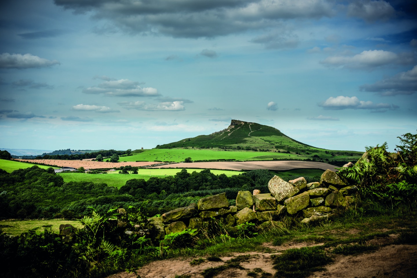
The summit of Roseberry Topping was always described as a ‘sugarloaf’ until in 1912 its west side collapsed, creating the now-iconic shape that has led it to be called the ‘Yorkshire Matterhorn’. From the summit we can see Captain Cook’s monument on Easby Moor.Leaving the Topping we descend along the spine down the stone steps to Roseberry Common. Crossing the common and keeping to the stone path, we climb ‘Little Roseberry’. From here we join the Cleveland Way, passing through a gate onto Newton Moor. Continue right with the wall on your right across the moor and down to Gribdale Gate car park, another popular point for joining this walk. There is also a small picnic area at this car park, but no toilets. From here we continue up the path through the woods signposted Cleveland Way/Kildale. This maintained track soon brings Cook’s Monument into view. At the monument we turn right, cutting slightly back on ourselves (3), and descend through some old stone gateposts and onto the track down through Ayton Banks wood.
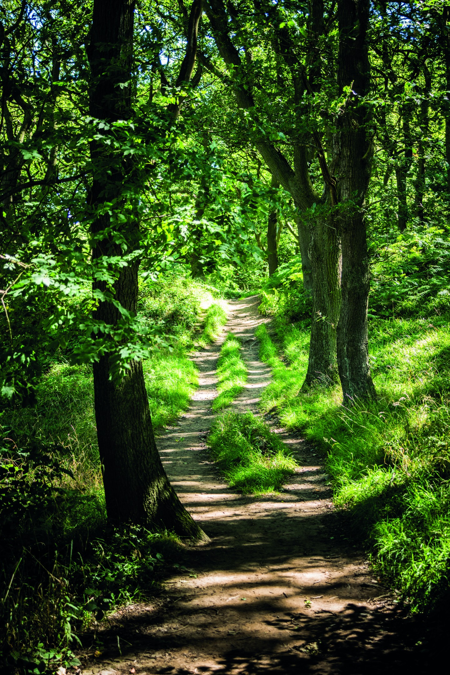
Where the track splits we bear left and follow the increasingly steep track down across the forest track until we meet the (rather narrow and unmarked) bridleway. Turn right onto the bridleway and continue down (4). We emerge onto a country lane at the crossroads with Dikes Lane, and continue directly opposite onto Aireyholme Lane. On your right is Aireyholme Farm, where a young Captain Cook once lived. Continue up the lane until we reach the footpath sign. Turn left here and head across the field, through the gate, and into Cliff Ridge Wood. Continue along the path until you can see some old metal gates (or what is left of them). Just before reaching these, turn left down the steps and onto the path out of the woods. At the gate turn right along the edge of the field, through the gate and straight across the lane, continuing onto the path opposite. Carefully cross the railway line and follow the fenced path back towards Great Ayton. We finally emerge from a short fenced and wooded path onto Newton Road. The gate opens directly onto the road and there is no footpath so take care when emerging and crossing the road. From here you will pass many tempting cafes and pubs on the route back to your car. Enjoy a slice of cake: you’ve earned it with this walk.